Private Utility Locates
Design Survey Locates & Private Locates in Washington State (Everett, Renton, Seattle, & Tacoma) and Oregon (Eugene & Portland)
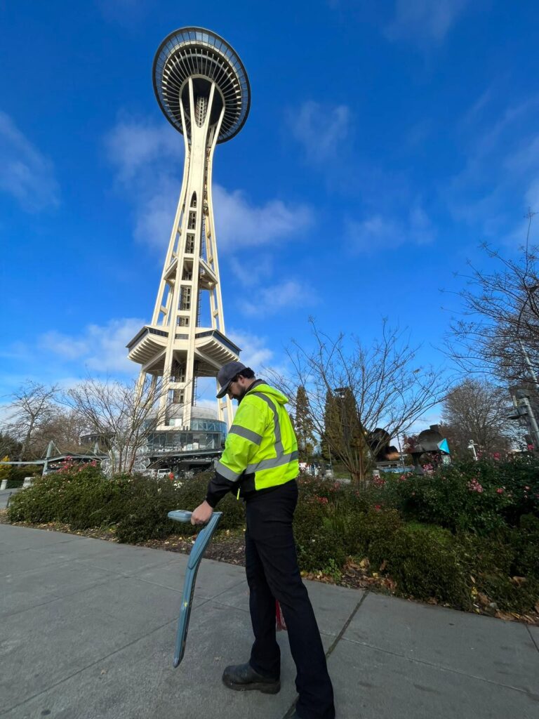
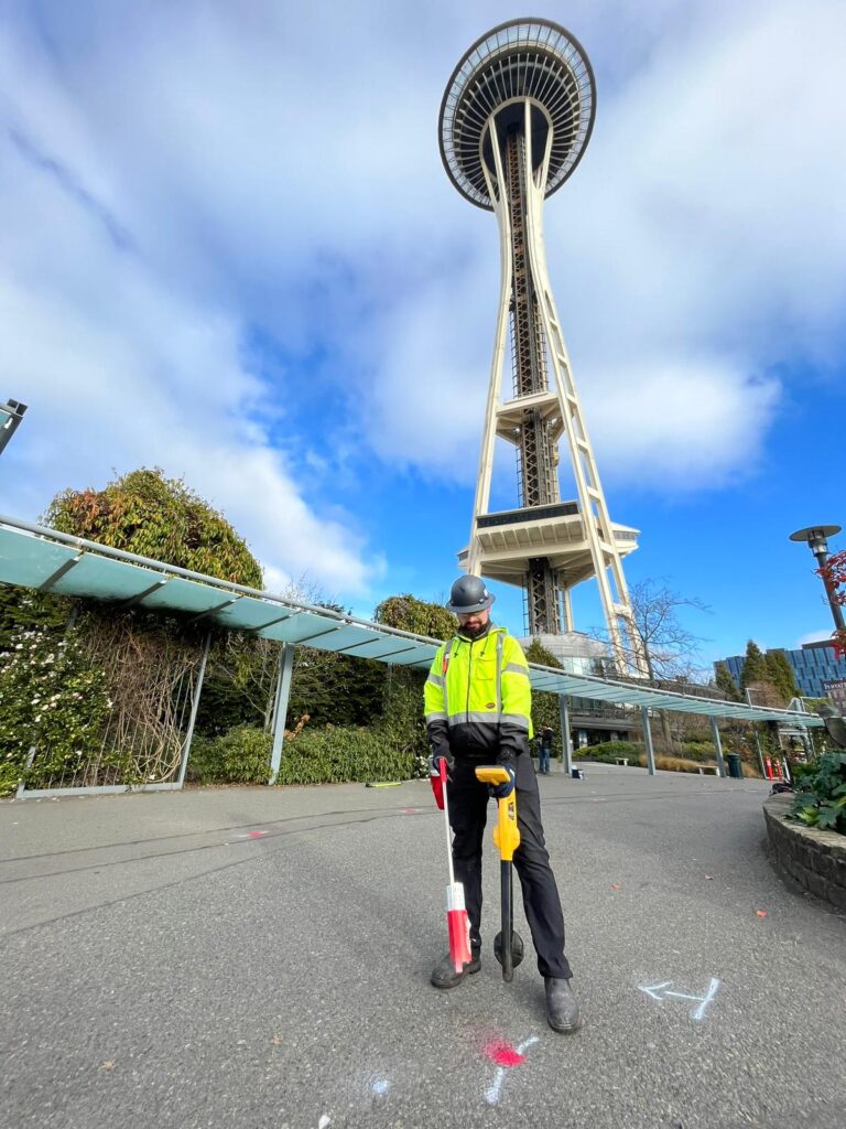
Utility Locates
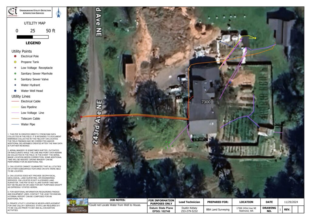
The Utility Notification Center (811) is responsible for marking all publicly owned utilities but will not typically mark depths, privately owned utilities, or design survey requests (sent to 811). CNI Locates has the ability to designate the location of public and private utilities with the latest underground utility locating technology. To receive a comprehensive/complete locate, a private utility locating firm must be utilized to ensure that all buried utilities are located. This service allows contractors, engineers, property management companies, and anyone else to develop or update as-built drawings. Clients use these files for preplanning, to avoid utilities, or to document the history of their site on various CAD and GIS systems.
Active Methods
An active signal is a signal that has been artificially generated by an external source. Active electromagnetic methods can allow different services such as but not limited to telephone and electric to be individually identified. Active methods involve the use of a transmitter. The transmitter can either be used for direct connection or for induction. Direct connection involves the application of an active signal to a conductor using a clip or clamp. Induction involves a signal being radiated from the internal antenna of the transmitter which is induced to any conductors in the vicinity and re-radiated. Generally, 8, 33, 65, or 83KHz frequencies are used. It is often possible to determine the depth of the service in these modes.
Passive Methods
A passive signal is a signal that occurs ‘naturally’ on a buried conductor. Passive electromagnetic methods will provide an indication only that services are present underground. Passive methods use the electro-magnetic fields already present around the underground utility to locate them. Two modes are generally used:
- Power – detects 50-60Hz energy present on most buried conductors
- Radio – detects re-radiated radio frequencies often present on conductors – it is not possible to determine depth in this mode.
Surveying in the traced services
As the survey progresses the positions of the detected services are marked unobtrusively onto the ground surface. Our clients receive field markings in the form of paint, pin flags, stakes, or any other method they request. The coordinates of these points can be surveyed using a total station allowing quick and accurate transfer into AutoCAD.
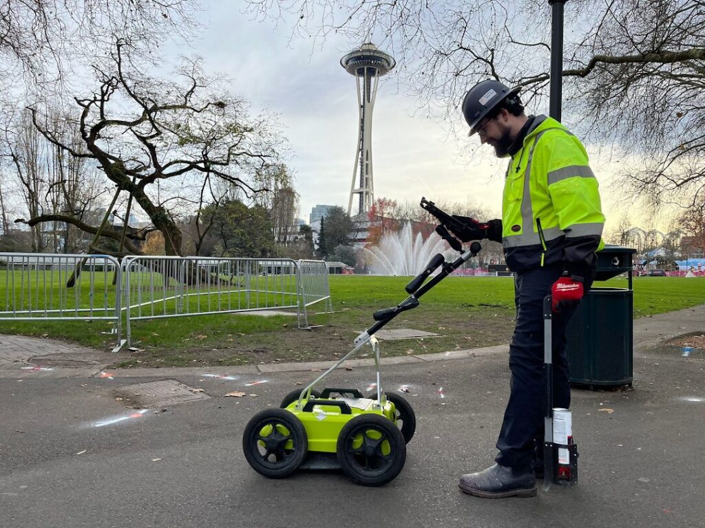
Ground Penetrating Radar (GPR)
Electromagnetic techniques are unable to detect non-metallic buried services including plastic water and gas pipes and clay drainage pipes. To overcome this potentially hazardous situation, we can often combine the use of Radiodetection with Ground Penetrating Radar (GPR). GPR is able to detect nonmetallic as well as metallic pipes. It will also give an indication of the location and depth of buried services but will not identify them.
GPR works by emitting a short pulse of energy into the ground. Echoes are returned from the different interfaces between different materials in the ground. As the antennae emit a “cone” shaped pulse of energy an offset target showing a perpendicular face to the radar wave will be “seen” before the antenna passes over it. Resultant characteristic diffraction pattern is thus built up in the shape of a hyperbola. A classic target generating such a diffraction is a pipeline when the antenna is traveling across the line of the pipe. However, it should be pointed out that if the interface between the target and its surroundings does not result in a marked change in velocity then only a weak hyperbola will be seen, if at all.
Quality Levels
- Level 1-Public Utilities’ record collection will include a search of all accessible records in the work area. This is a low-cost assessment of the site to demonstrate the extent of the utilities. All the records we collect are distributed to our clients, so they can be used for preliminary engineering and design surveys. This service has a low level of accuracy and may totally omit some types of utilities and recent additions/alterations.
- Level 2-Electromagnetic survey in passive and active modes, with located utilities being marked onto the grounds surface. A quick low-cost site assessment mainly useful for locating metallic pipes/lines (e.g., tv, telephone, alarm, signal, gas, steam, oil, petroleum, chemical, air, water, power, traffic control, electrical, lighting, irrigation control wires, etc.). In addition to on-site communications from our technicians, our clients receive field markings in the form of paint, pin flags, stakes, or any other method they request. We train our technicians thoroughly, to make sure that all the field markings they apply are clear and easy to understand. Clients will also receive a job description with pictures describing our findings. This service is useful for construction services like trenching, boreholes, driving ground rods, site improvements, utility improvements, and preliminary engineering. Will not detect non-metallic utilities. No records collection or utility mapping (unless requested).
- Level 3-Level 2 & Depth assessments in active mode. Will not detect non-metallic utilities. No records collection or utility mapping (unless requested)
- Level 4-Level 3 & lifting of all accessible manholes, handholes, vaults, valve covers, meters, catch basins, etc… Rodding a Sonde, flex rod, or video camera (if requested) through gravity pipes (e.g., sewer, drainage, etc.) & unoccupied conduits to assess the location of the pipe and its approximate depth. Electromagnetic detection and insertions will not detect plastic gas, water mains, and fiber optic cabling etc. (unless we have an access point to insert the line). No records collection or utility mapping (unless requested).
- Level 5-Level 4 & Acoustical plastic water pipe detection. We are typically able to locate services up to 100’-150’ depending on multiple variables (size of pipe, depth of pipe, soil condition, amount of t’s, elbows, and angles, etc.). We are not typically able to hear any lines over 4 feet deep (Homeowners must give CNI Locates approval to hook onto their water lines). No records collection or utility mapping (unless requested).
- Level 6- Levels 3 & GPR survey over targeted sections/utilities of the site identified from Level 3. This is a “lower cost” GPR survey, for understanding complex areas/utility depths. No records collection or utility mapping (unless requested).
- Level 7-Level 5 & GPR survey over targeted sections/utilities of the site identified from Levels 1-5. Collect data, process, analyze, interpret results, and mark the line & depth onto the grounds surface. This is for understanding complex areas/utility depths. No records collection or utility mapping (unless requested).
- Level 8-Level 5 & GPR survey over whole survey area. This is the most comprehensive level of survey (without potholing). It has the highest expectation of picking up all detectable utilities and other underground obstructions. Collect data, process, analyze, interpret results, and mark the line & depth onto the grounds surface. The client also has the option to have CNI Locates scan in 3’ or 18” orthogonal grids, if requested. This improves the quality of the deliverable and objects identified. No records collection or utility mapping (unless requested).
- Level 9- Levels 1-8 & any additional service that is requested. (e.g., Utility Mapping, Aerial Drone Imagery, Concrete Scanning, Magnetic Detection, Leak Detection, Fault Detection, Crawler Inspections).