

In this 5th and final chapter of our multi-blog series about LiDAR, Aerial Drone Imagery, archeology, deep learning and old infrastructure in the state of Washington (and particularly in Seattle), we’ll be shining light on how machine learning is helping Utility Locating companies provide a better service to their customers.
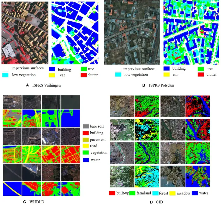
Remember Wang and colleagues’ 2024 study of Jinancheng? Their U-Net semantic segmentation framework achieved over 94% precision in identifying ancient city walls in LiDAR data (Wang et al., 2024). The algorithm learned to recognize the subtle topographic signatures of archaeological features, automating a process that once required painstaking manual interpretation.
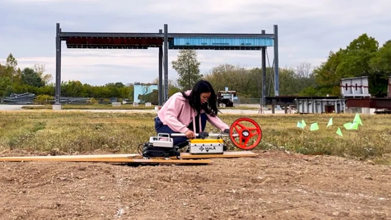
The same approach is now being applied to utility locating. Researchers at Purdue University have developed a “patent-pending method to decrease hazardous strikes to underground utility pipes” by using an “uncertainty-aware model” to better interpret ground-penetrating radar (GPR) data. The model identifies not just where utilities might be, but how confident the system is in each detection – allowing human operators to focus their attention on those specific areas that have the least amount of “confidence score”.
Similarly, researchers at Cairo University have proposed a framework using a “Mask R-CNN Deep Learning Model” to “automate and enhance the process of subsurface utility detection” from GPR scans. Just as Wang and colleagues tailored their U-Net architecture to the specific characteristics of ancient walls, these researchers adapted their models to the unique signatures of buried pipes and cables.
From 120 Days to 24 Hours: The PSE Transformation
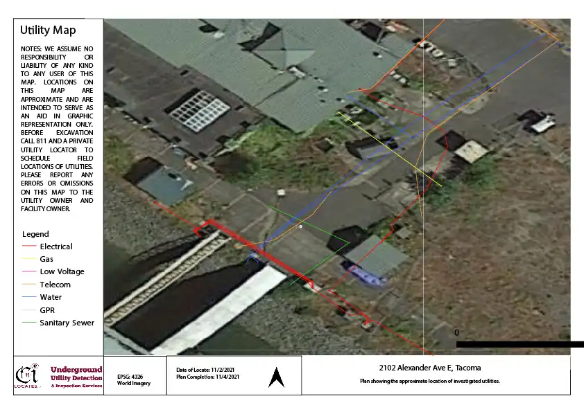
Perhaps the most dramatic example of technological transformation in Washington state comes from Puget Sound Energy (PSE), one of the state’s largest utility providers. Facing the limitations of traditional locating methods, PSE embarked on a comprehensive modernization of their approach to underground asset management.
The results have been remarkable. By implementing “high-accuracy GPS data collection” and a digital construction management platform, PSE achieved “near real-time visibility to our underground assets” and “increased confidence in the accuracy of our records.” Most impressively, they reduced the delay for data to appear in their GIS from 120 days to just 24 hours – a 99% improvement in update speed.
Even more striking is the improvement in accuracy. The error rate for field corrections – situations where as-built conditions differ from records – dropped from 42% to just 1.5%. This means that when PSE crews dig today, they can be sure that their maps have a really high degree of confidence.
Although nothing in the business of Utility Locating can be guaranteed with a 100% certainty, this transformation mirrors what archaeologists experience when moving from traditional survey to LiDAR-based mapping. The Carnegie Institution’s map of Mayapán, created through decades of careful fieldwork, contained significant errors that the LiDAR survey revealed (Hare et al., 2014). Similarly, PSE’s legacy records, created through handwritten notes and survey wheel measurements, contained discrepancies that modern GPS and digital workflows eliminate.
Data Integration: The Key to Both Fields
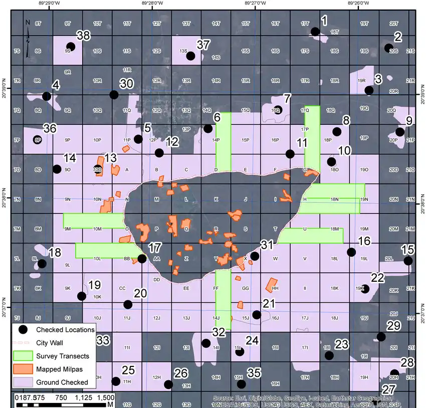
The most striking parallel between archaeological LiDAR and utility locating lies in how both fields are evolving toward integrated data systems.
Archaeologists no longer simply look at LiDAR images in isolation. As Hare and colleagues demonstrated at Mayapán, they combine LiDAR data with pedestrian survey, surface collection, test excavations, and artifact analysis within a Geographic Information System (GIS) (Hare et al., 2014). The LiDAR provides the framework, but the other data sources provide the interpretation.
Similarly, modern utility locating integrates multiple data sources:
- LiDAR or Aerial Drone Imaging scans provide surface context
- Ground-penetrating radar reveals subsurface features
- Electromagnetic locating detects metallic utilities
- Acoustic methods locate non-metallic pipes
- Historical records document past installations
- GIS databases store and visualize all this information
The result, in both fields, is a comprehensive understanding that no single technology could provide alone. As PSE’s experience demonstrates, “digital twins” that integrate surface and subsurface data are becoming the new standard for infrastructure management.
New Tools for the Job
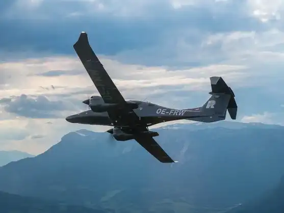
The technology available to utility locators continues to advance. New LiDAR systems are being specifically designed for infrastructure applications. The RIEGL VQ-1060, for example, is “purpose-built for applications such as power line, pipeline, and highway mapping.” Mounted on a fixed-wing aircraft, these systems can survey vast areas quickly and safely, providing the detailed surface context that subsurface data requires.
These systems address a key challenge identified by Snohomish County the following document titled “Environmental Mapping Incorporating LiDAR, Satellite Imagery, and Existing GIS Data”. Particularly the cost savings:
“The original estimates for a ground based survey of hydrography and slopes for our study area were for $13.2 million. The budget for this project was not to exceed $500 thousand which included the collection of LiDAR for a significant portion of the County. The City of Everett also partnered with the County for this LiDAR acquisition.”
As we said previously, CNI Locates DO NOT use LiDAR as the scale of our work doesn’t really require it. That type of technology is designed for much larger infrastructure projects and therefore requires either a helicopter or a fixed-wing aircraft to operate. In our day-to-day work, we use Aerial Drone Imagery to provide a substitute for a significantly lower cost. That being said, we can’t wait to see what the future holds and perhaps those LiDAR modules might get small enough & more importantly – precise enough to operate out of an aerial drone mounted system.
And LiDAR is definitely not the only advancement we are keeping our eyes on. If you want to keep reading about similar topics and much more, don’t forget to visit our blog section regularly or update your RSS feed.
Practical Applications in Washington State
Anyway, let’s shift the focus back to the important things. What does this mean for Washington state residents and businesses?
For homeowners: Modern locating services can create comprehensive maps of everything buried on your property – from septic systems to natural gas lines. Before you start that backyard excavation project, advanced technologies can ensure you know what lies beneath.
For contractors: Integrated models of job sites, combining surface Aerial Drone Imagery with subsurface GPR data, provide unprecedented situational awareness. Just as archaeologists can now visualize ancient cities in their entirety, contractors can visualize complete underground environments before breaking ground.
For municipalities: Cities across Washington are building comprehensive utility databases that combine historical records with modern surveys. Like the Mayapán LiDAR project that “updated and completed the city map,” these efforts are helping in the creation of an accurate, up-to-date records of underground infrastructure.
For public safety: More accurate utility locating means fewer strikes, fewer service interruptions, fewer environmental damages, and fewer injuries. The $30 billion annual national cost of utility damage (Purdue University, 2023) represents not just economic loss, but real human and environmental costs that better technology can reduce.
The Ethical Dimension: Knowledge and Responsibility
Reese-Taylor’s critique of the “lost cities” narrative carries an important lesson for utility locating (Reese-Taylor, 2025). Just as archaeologists must acknowledge that Indigenous communities often knew about “lost” sites all along, utility locators must recognize that “unknown” utilities are often known to someone – just not properly documented.
This recognition carries responsibilities:
- Preserving institutional knowledge before it walks out the door with retiring workers
- Digitizing historical records before they deteriorate or are discarded
- Engaging with communities who may remember when and where utilities were installed
- Building systems that make knowledge accessible rather than letting it become lost
The goal is not just better technology, but better stewardship of the knowledge we already have.
For Washington state residents, the message is clear:
The Law requires you to call 811 to locate your public utilities before you dig. Private Utilities account for more than 50 percent of utilities in most work areas. That’s why you should make CNI Locates Underground Utility Detection and Inspection Services your second call. Determining the difference between public and private utilities can be difficult, it varies from state to state and municipality to municipality. CNI Locates has the expertise and experience to interpret these complexities for you. Our advanced locating capabilities include Metallic Line Detection (known as Electromagnetic Detection), Non-Metallic Pipe Detection, Magnetic Detection, Structural & Concrete Imaging, Ground Penetrating Radar, Leak Detection, Electrical Fault Detection, and Video Pipe Inspections of Public and Privately-owned utilities. These services prevent costly damages, project delays, and help keep you and your crews safe. Give CNI Locates a call today at 877-826-1177 to go over any questions you may have, and we would be more than happy to assist. We just need 24 hours’ notice Monday through Friday to schedule for the next business day.
Part 1: How Archeologists Used LiDAR to Uncover Ancient Mysteries Hidden Beneath the Surface
Part 2: How LiDAR is Transforming Archeology with the Help of Deep Learning
Part 3: Beyond Detection: Understanding Urban Organization
Part 4: The Hidden World Beneath Our Feet – Utility Locating in Washington State
