One step in the solar energy development life cycle that is often not being considered across residential, commercial, and utility sectors is subsurface utility mapping. What lies beneath the surface needs to be understood before installing solar panels or laying down cables. Otherwise, you might experience unexpected delays, damages to the property, and safety issues.
Whether you’re installing a small rooftop system or managing a large solar farm, it’s important to observe the underground conditions thoroughly. Any objects or obstacles in the way below may exert some degree of interference with the construction, the design, or the long-term performance of your solar setup.
These hidden elements include underground utilities, tanks, old concrete footings, buried pipes, or drainage whose existence may not be visible to the naked eye or shown on blueprints.
Underground Obstacles That Can Impact Solar Sites
In a solar project, trenching might be required for running conduits and installation of ground screws or piles, along with places for anchorage. Contractors may damage existing lines or buried objects without knowing what lies beneath.
Here are a few problems that may occur without proper scanning:
- Project slowdowns caused by unexpected discoveries
- Damage to existing lines, like gas, water, or telecom
- Costly repairs or rework if utilities must be relocated
- Injury risk to crews hitting electrical or pressurized lines
- Delays in permitting or inspections due to site hazards
Taking time to inspect subsurface conditions reduces these risks and helps contractors stick to schedule and budget.
How It’s Done: Common Subsurface Methods
Different tools and technologies have been deployed for data gathering beneath the surface without any excavation. Some of the most useful techniques are shown below:
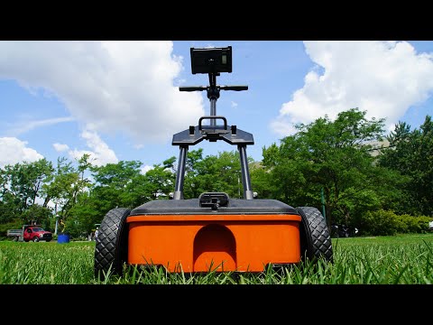
- Ground penetrating radar scanning, which sends radar pulses into the soil and detects reflections from underground objects or material changes
- Electromagnetic locating equipment to trace metallic lines and pipes
- Drone photogrammetry services that provide detailed aerial site models for better planning and layout
- Video pipe inspections that help detect underground drainage issues or existing utility conditions
Using these methods together gives engineers and site managers a clear and well-rounded view of the space before construction begins.
What to Look for Underground
Many solar installation sites, particularly those set up on reused lands or on undeveloped areas, may hide surprise features beneath their grounds. A subsurface investigation may bring to light information on:
- Old or abandoned utility lines.
- Private electrical or water lines
- Buried concrete pads or footing systems
- Septic tanks or underground storage tanks locate service needs.
- Utility splices or disconnected service points
This information helps avoid conflicts with existing infrastructure and may even affect panel layout or foundation decisions.
Partnering with a Locating Expert
Working with experienced professionals can enhance the planning process for solar contractors and site planners. C-N-I Locates is a private locating company trusted throughout Oregon and Washington to detect and record underground features using precision tools and skilled technicians.
We assist solar projects in various ways, ranging from ground penetrating radar to aerial imaging and utility mapping services for the provision of safer and more efficient project environments.