

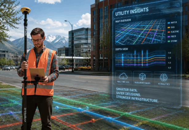
The subsurface environment at construction sites is becoming increasingly complex each year. Aging infrastructure, urbanization, and the need for further development have created a need for a way to understand what lies beneath the earth’s surface before subsurface work begins. Private utility locators play a crucial role in providing valuable information about underground infrastructure before any excavation or drilling is conducted on a site. Technology has continued to evolve utility locates from mere detection techniques to data collection.
Moving Beyond Traditional Detection Methods
Conventional methods for locating utilities have relied on instruments that can detect signals generated by conductive utilities and on field observation to identify underground utilities. These techniques remain relevant, but current projects may require additional information due to dense utility corridors, changing site conditions, and limited access to existing records.
The new technologies make it easier for technicians to collect and organize field information. Using advanced receiver equipment, sophisticated sensor devices, online maps, and improved data processing tools, technicians can evaluate underground utilities using various types of information, rather than relying solely on a single source.
This new development does not mean disregarding professional expertise. On the contrary, this is an effective tool to support experienced technicians.
How is Advanced Imaging Expanding Utility Detection?
One of the key advancements in current location technology is the growing application of subsurface imaging. Ground penetrating radar utility locating serves as a valuable tool in uncovering additional information about underground features that are inaccessible through conventional locating technology.
Ground Penetrating Radar (GPR) technology uses electromagnetic pulses to produce images of subsurface conditions. GPR might help detect underground features such as non-conductive utilities, voids, buried features, tanks, and other anomalies, depending on soil type, moisture content, site accessibility, and other conditions.
In the future, GPR will continue advancing, developing more efficient and accurate data interpretation and visualization tools. Nevertheless, one should still consider the influence of environmental conditions on GPR results.
The Rise of Digital Mapping and Data-Driven Locating
Modern utility locating is increasingly linked to digital documentation. Rather than just physical markings in the field, there will be a need for digital documentation to support future planning and asset management.
Utility locating specialists are using various techniques, including GPS data collection, cloud reporting, and digital maps, among others, to provide systematic documentation of the findings from the locating process. The use of such documentation enables planners to manage the projects effectively.
Further developments may lead to a combination of locating technologies, mapping systems, and project management systems, making field-collected information more easily accessible to different users.
Preparing for the Next Generation of Utility Detection
With increased demand for construction, both businesses and owners need precise information on underground conditions before commencing a project. The latest utility detection services in Washington have continued to change through the use of equipment, improved documentation, and inspection processes, which contribute to adequate project preparation.
Future utility locating services will prioritize integrating various techniques, ensuring data availability, and enhancing documentation. However, they will also maintain realistic expectations for each service’s detection capabilities. This development will enable the collection of valuable information while acknowledging the technical limitations of each service.
Conclusion
There have been changes in locating utilities through the utilization of advanced technology in this era. Using advanced imagery, digital maps, and various detection and inspection techniques, current locating services offer tools to understand the underground before construction begins. Experienced professionals at CNI Locates LTD understand the latest trends and offers advanced detection and inspection services to help its clients access underground information.
