

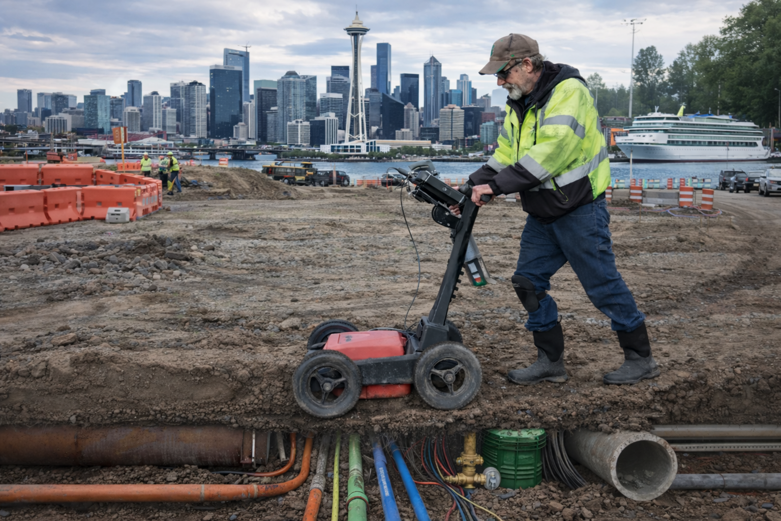
Ground Penetrating Radar (GPR) is widely used in subsurface investigations because it can help identify underground anomalies that may not be detectable using conventional locating methods. In projects involving excavation, construction, or infrastructure maintenance, ground penetrating radar services in Washington are often used to assist technicians in evaluating subsurface conditions before work begins.
However, it is important to understand that GPR is not a universal solution capable of detecting every underground utility or condition. Like all subsurface investigation technologies, GPR has operational limitations that depend heavily on soil conditions, material composition, site accessibility, and depth. Understanding these limitations helps contractors, engineers, and property owners make informed decisions before excavation activities begin.
How Ground Penetrating Radar Works
Ground Penetrating Radar operates by transmitting electromagnetic pulses into the ground through a specialized antenna. When these signals encounter changes in subsurface material such as pipes, conduits, voids, or structural elements, the energy is reflected back to the surface and recorded by the radar system.
Technicians interpret these reflections to identify patterns that may indicate buried utilities or other subsurface features. Because of its ability to detect anomalies beneath the ground surface, ground penetrating radar services are commonly used to complement traditional locating methods during utility investigations.
Despite these capabilities, GPR does not directly “see” utilities in the way imaging technologies might suggest. Instead, it identifies changes in subsurface conditions that trained technicians interpret based on experience, supporting data, and additional locating methods.
Site Conditions Can Affect GPR Performance
One of the most important factors affecting radar performance is the surrounding soil composition. Certain materials can significantly reduce the effectiveness of radar signals.
Conditions that may limit the effectiveness of GPR include:
- Highly conductive soils, such as clay, can absorb radar signals and reduce penetration depth
- High moisture levels that interfere with signal transmission
- Reinforced surfaces where dense steel reinforcement can obscure radar reflections
- Mixed subsurface materials that produce complex signal patterns
Because of these variables, GPR results depend heavily on site conditions at the time of investigation. Technicians often evaluate multiple factors before determining whether radar technology will provide useful information.
Depth and Resolution Limitations
Depth capability is another factor that can affect radar performance. While radar can detect certain subsurface anomalies, signal penetration and resolution can vary significantly depending on the environment.
Factors influencing depth detection include:
- Soil density and composition
- Ground moisture levels
- Utility size and material type
- Surface conditions such as pavement or concrete
In many cases, technicians may identify anomalies that suggest the presence of underground infrastructure. However, precise depth measurements cannot always be confirmed due to these environmental variables. As a result, depth assessments are typically considered estimates rather than exact measurements.
Why GPR Is Often Used Alongside Other Methods
Because radar technology has environmental limitations, it is commonly used as part of a broader investigation approach rather than as a standalone locating solution.
For example, projects involving private utility locating services in Washington often rely on multiple detection methods working together to improve visibility and confirm findings.
These methods may include:
- Electromagnetic locating to trace conductive utilities
- Magnetic detection to identify ferrous infrastructure
- Traceable flex rods or sondes to track non-conductive pipes
- Acoustic detection techniques for pressurized water systems
Combining several technologies allows technicians to compare results and work around the limitations of any singular method.
Similarly, when projects require digital documentation of surface markings, data collected during locating investigations may later support subsurface utility mapping when mapping deliverables are requested by the client.
The Importance of Understanding Technology Limitations
Subsurface investigations always involve some level of uncertainty because underground conditions are rarely uniform. Site disturbances, unknown installations, soil variability, and infrastructure age can all affect what technologies are able to detect.
Recognizing these limitations is essential when planning excavation or construction activities. Investigative technologies help improve visibility beneath the ground surface, but they cannot eliminate all unknowns.
Conclusion
Ground Penetrating Radar is a valuable investigative technology that can assist with identifying subsurface anomalies and supporting underground utility investigations. However, soil composition, site conditions, depth variability, and material differences can all influence the effectiveness of radar signals. Because of these limitations, radar is most effective when used alongside complementary locating technologies during subsurface investigations. For projects requiring professional investigation and coordination of multiple locating technologies, C-N-I Locates Ltd. provides services designed to assist contractors, engineers, and property owners in evaluating subsurface conditions before excavation or construction activities begin.
