

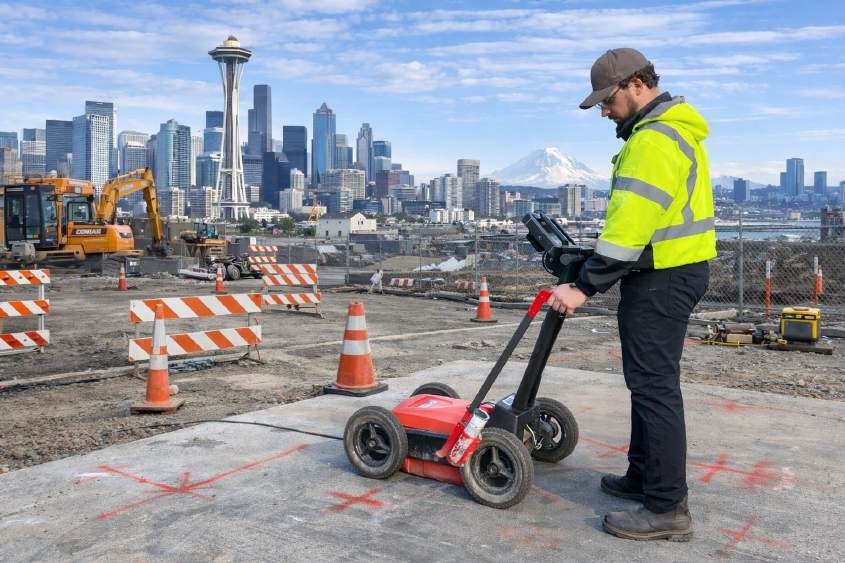
GPR concrete scanning is widely used to help identify embedded objects within concrete structures before cutting, drilling, or coring activities begin. In construction and renovation projects across cities like Tacoma and Seattle, understanding what lies beneath the surface is essential for reducing risk and avoiding unintended damage. Ground Penetrating Radar (GPR) is a non-destructive method that can assist in detecting features such as rebar, conduits, and post-tension cables.
However, it is important to understand that no subsurface investigation method provides complete visibility in all conditions. Technologies such as GPR can improve awareness of subsurface conditions, but results depend heavily on site variables, material composition, and accessibility. Recognizing these limitations allows contractors, engineers, and property owners to make more informed decisions when planning work involving concrete structures.
How GPR Concrete Scanning Works
Concrete radar refers to the use of Ground Penetrating Radar systems to transmit electromagnetic radio waves into concrete and analyze the reflected signals to identify embedded objects. These reflections are interpreted by trained technicians to identify patterns that may represent structural components or utilities within the slab.
GPR is commonly used to assist with locating:
- Reinforcement, such as rebar or mesh
- Post-tension cables
- Electrical conduits or plumbing lines
- Voids or inconsistencies within the concrete
While this method provides valuable subsurface information, interpretation is based on signal responses rather than direct visual confirmation. This means that results are influenced by how signals travel through the material and how clearly reflections can be distinguished.
Key Limitations of GPR in Concrete Scanning
Concrete scanning in Washington is subject to several operational and technical limitations that must be understood before relying on the results. These limitations are not failures of the technology, but rather natural constraints based on real-world conditions.
Common limitations include:
- Material composition: Dense or highly reinforced concrete can reduce signal clarity.
- Moisture content: High moisture levels may affect signal penetration and reflection quality.
- Reinforcement congestion: Closely spaced rebar can create overlapping signals, making interpretation more complex.
- Depth variability: As depth increases, signal strength decreases, which may limit visibility.
- Surface conditions: Uneven or obstructed surfaces can affect equipment coupling and data accuracy.
Because of these factors, GPR results should be viewed as an informed interpretation of subsurface conditions rather than an exact representation.
Why No Single Method Provides Complete Visibility
GPR concrete scanning is often used alongside other detection methods to improve overall understanding of subsurface conditions. No single technology can identify all utilities or structural elements in every environment.
Technicians may evaluate site conditions and recommend combining multiple approaches, such as:
- Electromagnetic locating to identify conductive utilities
- Magnetic detection for ferrous components
- Non-metallic line detection using inserts or sondes
- Visual inspection methods where access is available
These complementary methods help confirm findings and address limitations that may arise when using a single technology. The selection of methods depends on site conditions, accessibility, and project requirements.
Site Conditions and Accessibility Considerations
Concrete radar can only be effective when certain site conditions are met. Accessibility plays a significant role in determining how well scanning can be performed.
Important considerations include:
- Surfaces must be clean and accessible for scanning equipment
- Obstructions such as flooring, insulation, or coverings may need to be removed
- Elevated scan areas may require proper access equipment such as lifts or scaffolding
- Structural complexity may influence scan coverage and interpretation
Additionally, environmental and structural variables may affect how clearly subsurface features can be identified. These factors are typically reviewed with the client prior to scanning to ensure expectations remain realistic.
Importance of Verification and Safe Planning
Concrete scanning provides valuable information that can support safer planning, but it should not be used as the sole source of decision-making. Subsurface investigation technologies are most effective when combined with other available information.
This may include:
- Reviewing structural drawings or as-built plans
- Comparing scan results with known construction details
- Using multiple detection methods where appropriate
- Maintaining safe tolerance zones when performing cutting or drilling
In Washington State, any work involving excavation or subsurface disturbance should follow RCW
19.122 requirements, including contacting 811 to help identify public underground utilities. It is also important to recognize that 811 locates typically address public utilities and may not include private infrastructure within or around concrete structures.
Conclusion
Understanding the limitations of GPR concrete scanning in Washington is essential for making informed decisions in construction and renovation projects. While Ground Penetrating Radar can assist in identifying embedded objects within concrete, its effectiveness depends on site conditions, material properties, and accessibility. No single method can provide complete subsurface visibility, which is why multiple technologies are often used together to improve results.
By recognizing these limitations and combining appropriate detection methods, contractors and engineers can approach subsurface work with greater awareness and reduced risk. For professional support in subsurface investigation and concrete scanning services, C-N-I Locates Ltd. provides data-driven insights to assist with safer project planning.
