

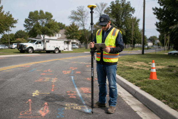
Construction, digging, renovation, and infrastructure projects need to plan everything properly before carrying out the work. Even though project management can review drawings and other existing documentation, underground features may not be entirely represented or even visible on the surface. It is essential to consider factors that might cause problems during project planning, coordination, and budgeting.
By using a utility locating service, project managers receive information about underground detectable infrastructure before carrying out any excavation, drilling, trenching, or coring work.
The Cost of Unexpected Underground Conflicts
Most delays in construction projects happen when the team encounter underground conditions they did not expect. A utility conflict in active work may need additional communication, site assessment, scheduling changes, or modifications to intended activities.
Examples of common issues faced with inadequate underground information include:
- Unexpected interruptions in construction activities
- Additional coordination with construction project teams and utility companies
- Modification of intended work sites
- Delays in the phases of the project
- More time is used for assessing site conditions
Early identification of underground conflicts can give project teams more information to work with.
How Utility Locating Supports Project Planning?
The use of a professional utility-locating service helps workers obtain information about underground conditions before carrying out on-site activities. The services may involve reviewing existing documents, assessing the site, identifying accessible utility points, and selecting detection methods based on project requirements and site conditions.
Electromagnetic utility locating services are popular for detecting conductive utilities that can carry detectable signals. If further investigations are necessary due to site conditions, other techniques may be used to provide additional information on underground conditions.
Utility locating doesn’t replace construction planning or site verification methods. Rather, it provides information that helps professionals assess underground conditions before any activity.
The Role of Technology in Utility Investigations
Underground conditions will differ from one project to another. There might be multiple utility lines, heavily congested passageways, abandoned structures, or materials that will need further assessment in urban locations, existing development areas, and active construction zones.
Ground Penetrating Radar (GPR) technology collects data on subsurface conditions by analyzing radar responses from underground utilities. The GPR system can assist in investigating cases involving non-conductive utilities, buried utilities, voids, and other subsurface conditions, provided it is used as part of an appropriate detection technique.
The GPR performance is affected by factors such as soil type, moisture levels, surface conditions, depth, and project access. Therefore, results need to be analyzed based on project-specific conditions.
Avoiding Delays Through Early Investigation
Unforeseen underground conditions could impact project schedules by requiring the team to pause, analyze available information, and adjust the planned schedule. Preliminary utility locating before construction will enable project teams to handle such scenarios more effectively.
The early investigation of utilities can be useful in:
- Enhanced coordination among project teams
- Effective planning in terms of work
- Greater insight into underground conflicts that may arise
- Fewer disruptions due to unforeseen conditions
- Effective communication of site constraints
Utility locating enhances decision-making by providing field data on detectable underground utilities.
Why Service Limitations Matter?
Utility locating services offer many benefits, but each has operational drawbacks. Weather conditions, the material composition of utilities, accessibility, crowding, the technology used, and other situational factors may affect the results of the location.
If depth readings are present, they are always estimates and depend on the signal’s response and site conditions. There may be underground objects that require specialized investigation techniques to locate.
Awareness of this is important so project teams can use their location data properly.
Supporting Cost Management With Better Information
Underground surprises may increase the need for coordination and scheduling during project implementation. Knowing underground conditions before work can help teams anticipate potential problems and make informed decisions about project activities.
A professional utility locating service in Washington provides information on visible/conductive underground utilities and informs clients of its limitations.
Making Informed Decisions Before Construction Begins
Each project has different site conditions, requirements, and problems. The purpose of utility locating is to help professionals understand what information is available about underground utilities and to consider any potential conflicts beforehand.
The professional team at CNI Locates LTD provides subsurface information through its utility detection, inspection, and documentation services. Our company helps contractors, engineers, and property owners start construction work more preparedly through a combination of field assessment and detection techniques.
