

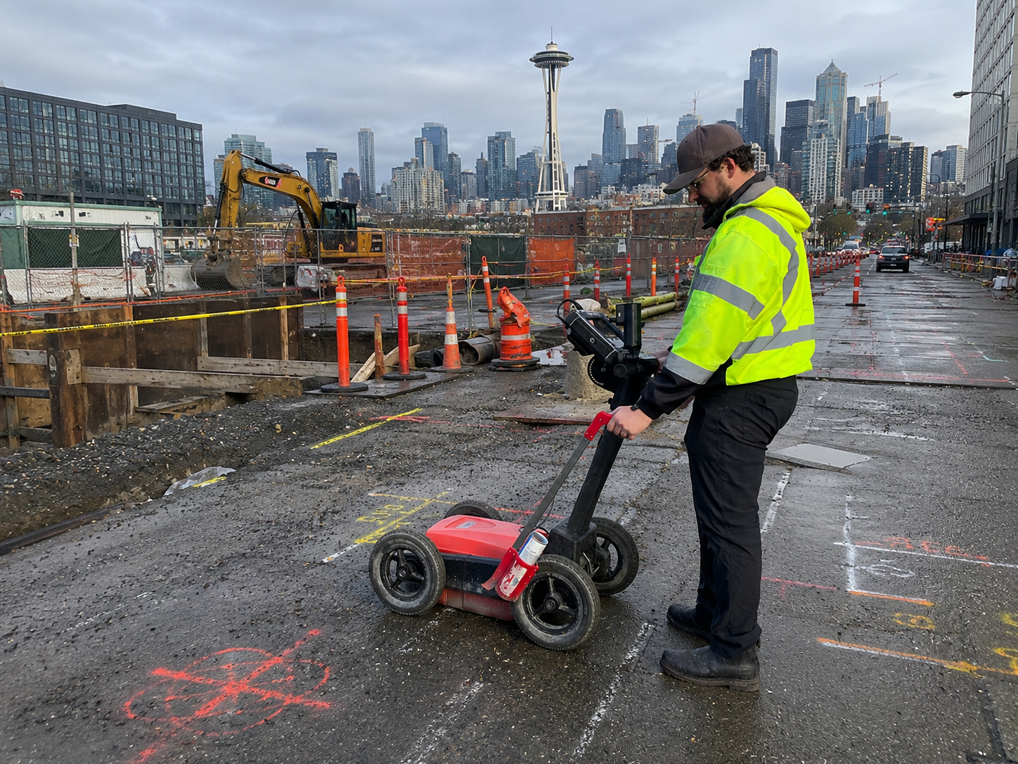
Urban construction and infrastructure projects often involve working around a complex network of buried utilities, structural features, and undocumented subsurface conditions. In these environments, GPR is frequently used as part of a multi-technology utility locating approach. By combining subsurface imaging with electromagnetic utility locating and other detection methods when appropriate, utility locating professionals can gather additional information about site conditions before construction, excavation, drilling, or infrastructure improvement projects begin.
Unlike conductive utility locating methods that depend on detectable signals, GPR uses subsurface imaging to identify changes beneath the ground surface. Because urban environments frequently contain a mixture of metallic and non-metallic infrastructure, GPR can provide valuable information when used alongside other utility locating technologies.
Why Urban Environments Present Unique Utility Locating Challenges
Cities and developed areas often contain decades of infrastructure additions, modifications, and repairs. As a result, utility records may not always reflect current site conditions.
Common challenges in urban environments include:
- Congested utility corridors
- Multiple utility crossings at varying depths
- Non-metallic utility lines
- Abandoned infrastructure
- Structural foundations and underground features
- Limited site access
- Surface obstructions such as pavement, landscaping, and buildings
A professional utility locate company evaluates these conditions before selecting the most appropriate detection methods for the project.
How Ground Penetrating Radar Supports Utility Locating
Ground Penetrating Radar works by transmitting electromagnetic signals into the ground and analyzing the reflections returned from subsurface features. Variations in material composition, density, and underground conditions can create identifiable responses within the collected data.
Depending on site conditions, Ground Penetrating Radar may assist with identifying subsurface responses associated with:
- Potential non-conductive utility lines
- Unknown underground features
- Utility corridors
- Underground storage tanks
- Voids or anomalies
- Buried structures and foundations
Because GPR detects subsurface changes rather than utility signals, it can complement electromagnetic locating methods when site conditions require multiple detection approaches.
Combining Technologies for Improved Site Understanding
No single locating method is effective under all site conditions. For that reason, many urban projects benefit from combining multiple technologies.
The utility locating process typically begins with a site review, evaluation of available records, identification of accessible utility connection points, and selection of appropriate detection technologies based on project requirements and site conditions.
Depending on site conditions, the locating process may involve:
- Electromagnetic utility locating for conductive utilities
- Ground Penetrating Radar for subsurface imaging
- Utility mapping for documentation and planning
- Acoustic detection methods, when applicable
- Supplemental investigation techniques based on project requirements
Using multiple technologies allows field technicians to compare findings from different data sources and develop a more complete understanding of site conditions.
The Role of GPR Concrete Scanning in Urban Projects
Urban construction frequently involves work inside buildings, parking structures, sidewalks, bridge components, and other concrete features. In these situations, GPR concrete scanning may be used to evaluate structural elements before cutting, coring, anchoring, or drilling.
GPR concrete scanning can assist with identifying embedded objects and subsurface features within concrete structures. Depending on the application, technicians may use specialized equipment designed for structural imaging to evaluate slabs, walls, columns, or other concrete components.
As with all subsurface imaging technologies, findings are influenced by material composition, reinforcement density, site accessibility, and other operational factors. Interpretation of scan data requires trained analysis and may be supplemented by additional investigation methods when necessary.
Understanding Operational Limitations
Ground Penetrating Radar is a valuable detection tool, but its performance can be influenced by environmental and site-specific conditions.
Factors that may affect results include:
- Soil composition
- Moisture content
- Surface conditions
- Reinforcement density
- Site accessibility
- Subsurface congestion
- Material characteristics
Depth estimates obtained through GPR are approximate and may vary depending on field conditions and interpretation factors. For this reason, GPR findings are typically evaluated alongside other available information and detection methods.
Conclusion
Urban infrastructure projects often require a detailed understanding of complex underground conditions before construction activities begin. By combining subsurface imaging with complementary detection technologies, a GPR utility locator in Washington can help identify potential underground features and support informed project planning. Whether the project involves utility investigations, utility mapping, or GPR concrete scanning, working with an experienced utility locate company helps ensure that available site information is collected, documented, and reviewed within the operational limitations of each technology. For professional utility detection, subsurface imaging, and utility locating services, C-N-I Locates Ltd. provides specialized field services tailored to project-specific requirements.
