

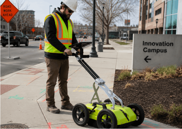
GPR scanning can give people the wrong impression. The majority of people hear of Ground Penetrating Radar and immediately assume it is a technique that will give them an exact picture of everything beneath the surface with just one scan. While GPR concrete scanning is a great technique, it relies on signal responses, data collection, and interpretation rather than imaging everything underground.
The difference matters because people’s impressions influence their perception of scanning results. Not every response indicates the presence of something underground, and each project has its own specific conditions. Ground Penetrating Radar is an excellent tool for detecting underground features when used properly, but understanding its capabilities and limitations is important for contractors and engineers to use it to the fullest.
GPR Does Not Work Like an Underground Camera
One common misunderstanding about GPR scanning is that it provides direct imaging of what lies beneath the surface. Unlike a camera, which captures what it sees, GPR detects electromagnetic responses originating below ground or within concrete structures. As radar passes through various materials, density, composition, and structure variations will result in various reactions. Experts will then analyze these reactions to determine whether any subsurface features exist, using the available information and site conditions.
A GPR utility locator can detect and identify subsurface features, such as non-conductive utilities, buried objects, voids, and other anomalies. The obtained information will help plan the project; however, these plans should always be analyzed in light of existing limitations and site conditions.
GPR Does Not Only Detect Utilities
People often assume that GPR is solely for locating underground utilities. Although it is widely used for this purpose, Ground Penetrating Radar can also be used to assess different subsurface conditions.
Based on the nature of the project, Ground Penetrating Radar can help in recognizing reactions from:
- Non-conductive utilities
- Underground storage tanks
- Anomalies
- Structures
- Concrete elements
- Unmarked graves
It recognizes reactions below the surface without automatically identifying all responses. It is reviewed based on data gathered in conjunction with existing records and the investigation’s objective.
GPR Does Not Replace Every Other Detection Method
Another misconception about GPR is that it can completely replace all other detecting techniques. However, different detection approaches yield different kinds of data. Electromagnetic utility detection is widely used to assess conductive utilities that generate signals. GPR provides subsurface images and helps professionals obtain more information about objects that do not yield information via electromagnetic detection.
Depending on factors such as the utility’s properties, access conditions, environment, and others, various detection methods can be used.
Every GPR Response Does Not Represent a Utility
There is often the belief that all marks, signals, and radar responses detected during scanning should be treated as utility lines. GPR detects differences in subsurface materials, and various objects beneath the ground surface can cause those differences.
Radar responses are interpreted using several criteria that include the following:
- Signal shapes
- Nature of material
- Subsurface conditions
- Environmental factors
- Project information
The proper interpretation of the findings is essential for understanding what the GPR detection results could mean.
GPR Does Not Always Provide Exact Depth Information
Depth is another area where assumptions and the reality of Ground Penetrating Radar differ greatly. It may be assumed that the technology gives precise measurements of the depth of every discovered object. In reality, depth measurements are based on multiple variables.
Variables affecting depth measurements may include:
- Soil type
- Soil moisture
- Properties of the material
- Distortion of the signal
- Surface conditions
- Congestion of the subsurface environment
Depth measurements are approximate and may differ depending on field conditions and various interpreting factors.
Understanding GPR Capabilities Helps Set Realistic Expectations
GPR is a technology that provides important data on subsurface and structural conditions; however, it performs best when the user understands its strengths and weaknesses. A professional GPR scan can help assess embedded features in concrete structures, including potential utilities, reinforcement, and other subsurface conditions. The results of concrete scanning can be affected by various factors, including reinforcement, material composition, moisture, and structural factors.
In Washington state, CNI Locates LTD offers Ground Penetrating Radar, utility detection, and inspection services to help contractors, engineers, and property owners obtain more information about subsurface and structural conditions. Using professional assessment in the field, the company helps the client better understand the site, while reminding them of the service’s limitations.
